
badmdcnman
FRIEND
Northwestern Minnesota
On the recent trip to AK I decided to pack the I pad and Stratus in the event I got a flight around McKinley that I might record my fligh track with Foreflight. The weather cooperated and allowed us to fly out of Talkeetna to enjoy one of the most spectacular flights I have ever made. With permission from the pilot I placed the Stratus in the cockpit and began monitoring our flight with my I pad and Foreflight on Synthetic Vision.
This proved to be one of the most memorable experiences of our trip and thought I would provide a glimpse of our flight as only pilots could appreciate. I grabbed a few screen shots off the I pad and recorded the flight track on Foreflight. The links below provide the approach flight as well as the departure flight. Best viewed on Google Earth via the KML link.
This first view is perhaps very familiar to folks in Alaska but for the rest of us this is Mt. Foraker on the left, Mt. Hunter in the middle and of course Mt. McKinley on the right.

A couple of views flying around the peaks. Our position indicated on Foreflight.
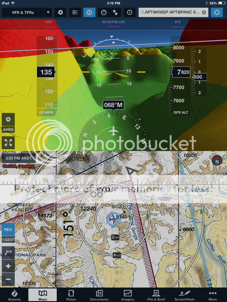
This is about as high as we got just short of 11,900 feet.


And of course a shot while parked on the glacier

And on the way out through the Great Gorge!!

If you want to check out the flight path on Foreflight you can see it by clicking on the following links.
The first is the approach and the second is the departure. Best viewed by clicking the KML button for Google Earth.
http://www.foreflight.com/s/track/1430781448-C8352F6D-3097-4A6F-A636-C185B2B87F2F/
http://www.foreflight.com/s/track/1430787340-B9245B72-61EA-40CC-AD25-99994F0BAA7A/
Hope you enjoy my photos from AK............Rod
Not sure how these thumbnails got here not sure how to remove them......


